|
Home
|

|
|
Exit 3
Alpha
Greenwich Township
Phillipsburg
Pohatcong Township
|

Continue west on 
|
EXIT 3
Directions
HARMONY TOWNSHIP
 Little Ridge Vineyards, 7 miles north Little Ridge Vineyards, 7 miles north
 Merrill Creek Reservoir, 7 3/4 miles NE Merrill Creek Reservoir, 7 3/4 miles NE
HOLLAND TOWNSHIP
Musconetcong Gorge Preserve, 3 3/4 miles south
PHILLIPSBURG
 Centerville and Southwestern Railroad, 4 miles NW Centerville and Southwestern Railroad, 4 miles NW
Delaware River Railroad Excursions, 4 1/2 miles NW
Invertase Brewing Co., 4 1/2 miles NW
POHATCONG TOWNSHIP
Alba Vineyard, 5 miles SW
Villa Milagro Vineyards, 7 miles SW
|
|
Exit 6
Asbury
Bloomsbury
Franklin Township
Warren Glen
|

|
EXIT 6
Directions
ALEXANDRIA TOWNSHIP
Ironbound Hard Cider, 4 1/4 miles SE
|
|
Exit 7
Bethlehem Township
Bloomsbury
West Portal
|

|
EXIT 7
Directions
BETHLEHEM TOWNSHIP
Jugtown Mountain Preserve, 3 1/2 miles east
|
|
Rest Area -
Milepost 7.9
No Facilities
|

|
|
|
Exit 11
Pattenburg
Union Twp (Hunterdon Co)
West Portal
|

|
EXIT 11
Directions
ALEXANDRIA TOWNSHIP
Beneduce Vineyards, 7 miles south
UNION TOWNSHIP
 Hunterdon Hills Playhouse, 1 1/4 miles east Hunterdon Hills Playhouse, 1 1/4 miles east
|
|
Exit 12
Jutland
Norton
Union Twp (Hunterdon Co)
|

|
EXIT 12
Directions
ALEXANDRIA TOWNSHIP
Mount Salem Vineyards, 3 3/4 miles south
UNION TOWNSHIP
Spruce Run Recreation Area, 4 miles NE
|
|
Exit 15
Clinton
Franklin Township
Pittstown
|

|
EXIT 15
Directions
CLINTON
Hunterdon Art Museum, 1/2 mile east
 Red Mill Museum Village, 1/2 mile east Red Mill Museum Village, 1/2 mile east
|
|
Exit 16
Clinton
Glen Gardner
Hampton
High Bridge
Washington
|

Continue north on 
|
EXIT 16
Directions
LEBANON TOWNSHIP
 Buzz Aldrin Astronomical Center, 4 1/2 miles north Buzz Aldrin Astronomical Center, 4 1/2 miles north
Teetertown Preserve, 11 miles north
Township of Lebanon Museum, 8 miles NW
Voorhees State Park, 5 1/2 miles north
|
|
Exit 17
Flemington
Lambertville via US 202 South
Pennington
Raritan Township
Trenton
Hunterdon Medical Center
|

Continue south on
|
EXIT 17
Directions
CLINTON TOWNSHIP
Hunterdon County Arboretum, 5 1/4 miles south
FLEMINGTON
Black River & Western Railroad, 10 1/2 miles south
RARITAN TOWNSHIP
Northlandz, 10 1/2 miles south
|
|
Exit 18
Annandale
Clinton Township
Lebanon
|

Continue east on
|
EXIT 18
Directions
CLINTON TOWNSHIP
Cushetunk Mountain Preserve, 5 miles east
Round Valley Recreation Area, 3 miles SE
LEBANON BOROUGH
Sunken Silo Brew Works, 2 1/4 miles east
|
|
Exit 24
Co. Rt. 523 North
Oldwick
Tewksbury Township
To Co. Rt. 517
Co. Rt. 523 South
Readington Township
Whitehouse
Whitehouse Station
|

|
EXIT 24
Directions
TEWKSBURY TOWNSHIP
Whittemore Wildlife Sanctuary, 3/4 mile north
|
|
Exit 26
Co. Rt. 523 Spur North
Bedminster Township
Lamington
Co. Rt. 523 Spur South
Branchburg Township
North Branch
Raritan Valley Comm Coll
|

|
EXIT 26
Directions
BRANCHBURG
Frontline Arts, 4 3/4 miles SE
NORTH BRANCH
The Planetarium at RVCC, 2 1/4 miles SE
RVCCArts, 2 1/4 miles SE
|
|
Exit 29
I-287 North
Basking Ridge
Bedminster Twp
via US 206 North
Bernards Township
Bernardsville
Boonton
Chester via US 206 North
Far Hills via US 202 North
Mahwah
Morristown
Peapack and Gladstone
Pluckemin
I-80
New York Thruway
I-287 South
Bridgewater Township via
US 202/206 South
Bound Brook
Edison Township
New Brunswick
Perth Amboy
Piscataway Township
Princeton via US 206 South
Raritan via US 202 South
Somerville
Staten Island NY
New Jersey Turnpike
Exits 9-1
Outerbridge Crossing
Princeton University via
US 206 South
Rutgers University
|

Continue north / south on 
Continue north / south on 
Continue north / south on 
|
EXIT 29
Directions
BEDMINSTER
Center for Contemporary Art, 1 3/4 miles north
Fairview Farm Wildlife Preserve, 8 miles north
BERNARDS TOWNSHIP
Somerset County Environmental Education Center,
9 miles NE
CHESTER
Bamboo Brook Outdoor Education Center,
8 1/4 miles NW
 Cooper Gristmill, 12 1/2 miles north Cooper Gristmill, 12 1/2 miles north
Hacklebarney State Park, 15 miles NW
Elizabeth D. Kay Environmental Center,
10 3/4 miles north
Willowwood Arboretum, 7 3/4 miles NW
FAR HILLS
Leonard J. Buck Garden, 4 3/4 miles NE
USGA Golf Museum, 6 miles NE
HARDING TOWNSHIP
 Great Swamp National Wildlife Refuge Great Swamp National Wildlife Refuge
Observation Area, 14 miles NE
Visitor Center, 10 miles NE
HILLSBOROUGH
Duke Farms, 7 miles south
LONG HILL TOWNSHIP
The Raptor Trust, 10 miles NE
MORRISTOWN
Morristown National Historical Park
Jockey Hollow, 12 1/2 miles NE
Fort Nonsense, 16 miles NE
Washington's Hdqtrs/Ford Mansion, 16 miles NE
PEAPACK-GLADSTONE
Natirar, 4 1/2 miles north
SOMERVILLE
Old Dutch Parsonage State Historic Site, 5 miles south
Wallace House State Historic Site, 5 miles south
|
|
Exit 33
Co. Rt. 525 North
Bernards Township
Bernardsville
Liberty Corner
VA NJ Healthcare System-
Lyons
Co. Rt. 525 South
Martinsville
Memorial Sloan-Kettering
Cancer Center
|

|
|
|
Exit 36
Co. Rt. 651 North
Basking Ridge
Bernards Township
Long Hill Township
Millington
Stirling
Co. Rt. 651 South
Dunellen
Green Brook
Warren Township
Warrenville
|

|
EXIT 36
Directions
BERNARDS TOWNSHIP
Farmstead Art Center, 1 mile north
GREEN BROOK
Washington Rock State Park, 4 1/2 miles SE
LONG HILL TOWNSHIP
Oakflower Brewing Co., 2 1/2 miles north
WARREN
ClubAir, 1 1/4 miles SE
|
|
Exit 40
Co. Rt. 531 North
Gillette
Long Hill Township
Co. Rt. 531 South
North Plainfield
Plainfield
Watchung
Muhlenberg Regional
Medical Center
|

|
EXIT 40
Directions
NORTH PLAINFIELD
Fleetwood Museum of Art and Photographica,
4 1/4 miles south
PLAINFIELD
Drake House, 3 3/4 miles south
|
|
Exit 41
Berkeley Heights
Fanwood
Scotch Plains
|

|
|
|
Exit 43
Berkeley Heights
Scotch Plains
|

|
|
|
Exit 44
Berkeley Heights
Murray Hill
New Providence
|

|
EXIT 44
Directions
NEW PROVIDENCE
Untied Brewing Co., 2 1/2 miles NW
|
|
Exit 45
Co. Rt. 527 North
Summit
Overlook Hospital
Co. Rt. 527 South
Mountainside
|

|
EXIT 45
Directions
MOUNTAINSIDE
Watchung Reservation
Trailside Nature and Science Center, 2 1/2 miles SW
SUMMIT
Bull N Bear Brewery, 2 1/2 miles north
Summit Playhouse, 2 1/4 miles north
Visual Arts Center of New Jersey, 2 miles NE
|
|
Lanes Divide - Milepost 48.4
Crossovers from Express to Local lanes
for Parkway and Airport
Express Lanes
Jersey City
Lower Manhattan -
Financial District
Holland Tunnel
I-95
New Jersey Turnpike
Local Lanes
Hillside
Newark
Springfield
Union
Garden State Parkway
Newark Liberty Int'l Airport
NJ 24
|
 
|
|
|
|
All following exits are Local except where noted
|
|
|
Exit 48
Chatham
Florham Park
Livingston
Madison
Millburn
Summit
Mall at Short Hills
|

Continue west on 
|
EXIT 48
Directions
CHATHAM
Gravity Vault, 4 1/2 miles NW
Great Swamp Outdoor Education Center,
6 3/4 miles NW
Twin Elephant Brewing Co., 4 1/4 miles NW
MADISON
Museum of Early Trades and Crafts, 6 1/4 miles NW
Shakespeare Theatre of New Jersey, 6 3/4 miles NW
SHORT HILLS
Cora Hartshorn Arboretum and Bird Sanctuary,
2 3/4 miles NW
SUMMIT
Carter House, 4 miles NW
Reeves-Reed Arboretum, 1 3/4 miles NW
|
|
Exit 49A
Springfield
Union
Exit 49B
Maplewood
|
 
Continue east / west on 
|
EXIT 49A
Directions
MILLBURN
Paper Mill Playhouse, 2 miles NW
SHORT HILLS
Greenwood Gardens, 2 1/2 miles north
WEST ORANGE
South Mountain Recreation Complex, 5 miles north
South Mountain Reservation, 4 1/2 miles NE
EXIT 49B
Directions
SOUTH ORANGE
South Orange Performing Arts Center, 3 1/2 miles NE
|
|
Exit 52
Garden State Pkwy North
Exits 143-172
Clifton
Hillsdale
Irvington
Montclair
Nutley
The Oranges
Paterson
Montclair State University
Seton Hall University
Garden State Pkwy South
Exits 141-0
Atlantic City
Cape May
Elizabeth
Freehold
Lakewood
Perth Amboy
Toms River
|

Continue north / south on 
|
EXIT 52
Directions
UNION
Liberty Hall, 3 miles SE
WEST ORANGE
Edison National Historic Site, 7 miles north
|
|
Exit 54
Hillside
Irvington
Newark - Weequahic
|

|
|
|
Exit 56
Newark - Clinton Hill/
Weequahic
|
Express Local
 
|
|
|
Exit 57
NJ 21
Belleville
Newark - Downtown/
Ironbound
Passaic
Prudential Center
Rutgers University - Newark
US 1-9
Newark Liberty Int'l Airport
|

|
EXIT 57
Directions
NEWARK
All Points West Distillery, 1 1/2 miles NE
Jewish Museum of New Jersey, 3 1/2 miles north
New Jersey Historical Society, 2 1/4 miles north
New Jersey Performing Arts Center, 2 1/4 miles north
Newark Museum of Art, 2 3/4 miles north
Paul Robeson Galleries, 3 miles north
|
|
Exit 58A
NJ 21
Newark - Downtown/
Ironbound
US 1-9 South
Elizabeth
Linden
US 22
Hillside
Exit 58B
US 1-9 North
North Bergen
Ridgefield Park
Secaucus
|
Express

Local
 
Continue north / south on 
Continue north / south on 
Continue north on 
Continue west on
|
|
|
New Jersey Turnpike
New Jersey Tpk/I-95 North
Fort Lee
Midtown Manhattan
New England
Rutherford
Secaucus
Teaneck
Westchester County NY
George Washington Bridge
Lincoln Tunnel
Meadowlands Sports
Complex
Meadowlands Arena
Meadowlands Racetrack
MetLife Stadium
New Jersey Tpk/I-95 South
Camden
Elizabeth
New Brunswick
Philadelphia PA
Trenton
Woodbridge
Delaware Memorial Bridge
Goethals Bridge
Outerbridge Crossing
|

Continue north / south on  
|
|
|
|
Begin tolled section of 
|
|
|
EXIT 14A - Milepost N3.3
Bayonne
Jersey City
Staten Island NY
Bayonne Bridge
|

|
EXIT 14A
Directions
JERSEY CITY
Afro-American Historical and Cultural Society Museum,
2 miles north
|
|
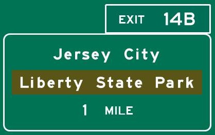
EXIT 14B -
Milepost N5.3
Jersey City
Ferry to Statue of Liberty
and Ellis Island
|
|
EXIT 14B
Directions
JERSEY CITY
Liberty State Park, 1 mile SE
RPM Raceway, 1/4 mile south
|
|
Toll Plaza -
Milepost N5.9
Pay cash toll or use EZ Pass
Exit 14C -
Milepost N6.0
Keep right through toll plaza
Jersey City
Light Rail Park and Ride
|

|
EXIT 14C
Directions
JERSEY CITY
Liberty Science Center, 1/4 mile east
|
|
Columbus Drive -
Milepost N6.6
Jersey City
|
 
|
Columbus Drive
Directions
JERSEY CITY
MORA Museum of International Art, 1 1/2 miles east
|
|
Twelfth St. -
Milepost N8.1
Jersey City
|
|
Twelfth St.
Directions
JERSEY CITY
Departed Soles Brewing Co., 1 mile SE
|
|
|
Home
|
|
